Drone Deliveries Part 2

Before we discussed the different things happening in the world of drone deliveries from the hospitals in North Carolina all the way over to Dubai and China. Just this past week UPS has applied for their part 135 certification which would allow them to start delivering packages via UAV’s (drones). If they can pull this off and word on the street is they are hoping too before the end of the year they will ‘have one of the first fully-certified, revenue-generating drone operations in the United States’ according to the article in UAS Magazine.
Scott Price the UPS Chief Transformation and Strategy Officer had this to say “UPS is committed to using technology to transform the way we do business, UPS’s formation of a drone delivery company and application to begin regular operations under this level of certification is historic for UPS and for the drone and logistics industries.”
Drone deliveries aren’t just a things here in the states as we spoke about in our last blog post and last month there was a VTOL (vertical takeoff & landing drone) that completed a 50 mile delivery in 28 minutes over in the Bahamas. The drone flew over both land & water and is able to transport perishables, mail, mechanical parts, and medicine.
Head to the FAA website for rules & regs regarding part 135 operations but basically it applies to air carriers & operators. Under this part 135 certification, UPS will be allowed to fly over people, fly at night and also fly beyond visual line of sight (bvlos.) These three factors are big in the UAV community right now because these are big no no’s for any other drone operators. It can be a very hard and lengthy process to receive any of those waivers.
Morgan Stanley has stated that by the year 2040 autonomous urban aircrafts could be a $1.5 trillion market! Crazy!!!
Let’s face it, drones are here to stay and every day we are discovering more and more reasons they are useful. Drones can free up those in mundane jobs to be more creative and think outside the box. Let’s get the creative juices flowing and start preparing for the drones of the future!

UAS Magazine : http://www.uasmagazine.com/articles/2050/with-ups-flight-forward-drone-delivery-operations-near-reality

Verge Magazine : https://www.theverge.com/2019/7/23/20707470/ups-drone-delivery-faa-certification-approval

Morgan Stanley : https://www.morganstanley.com/ideas/autonomous-aircraft

FAA Part 135 : https://www.faa.gov/about/initiatives/sas/135_certification/cert_process/

Fox News : http://www.fox5ny.com/news/drone-makes-first-commercial-delivery-in-the-bahamas

Drone…deliveries?

By now you’ve probably heard about drones making waves in the news by becoming modes of delivery. When I say delivery I’m not only speaking about packages! In Dubai, Chinese company EHang debuted their taxi drones, which can carry people!! EHang has been in business since 2014 and they have an interesting story. (*Check out this video from YouTube to learn more about their story, see the drones in action etc. We do not own this video nor its content but we thought it was really cool and gives good details about the company: https://youtu.be/zAQDFK-Ic0E )

Recently EHang partnered with DHL (the American founded German international courier company) to create a drone specific for carrying a delivery to parts of China. EHang created the Falcon Drone – which sports 4 arms and 8 rotors. In this particular part of China a road delivery would normally take around 40 minutes but with the Falcon the delivery time is cut down to 8 minutes.

As we keep delving and moving forward with drone technology we will start to see more and more things like this. Best to take it in stride and ride the wave to see where it goes. Every day we hear how close big companies like Amazon and Uber are to integrating drone technology to enhance their current services.

Does this drone delivery idea make you uneasy? Comment below and let us know how you feel! Are you excited about the opportunity? If you have questions about drones please refer to our blog post with drone FAQ’s.

UAV FAQ’s

We get a ton of questions regarding our UAV’s and we thought we would compile a list to help everyone! If you have a question you don’t see here make sure to email, message or comment with the questions and we can answer it and add it to our list.

  • Do you need a license to fly it?

A:  You don’t need a certification to fly for hobby purposes but if you are going to use it for commercial purposes or for any compensation or furtherance of a business, then YES you do need to become part 107 certified. (see our blog about Hobbyist Vs Part 107 HERE)

  • How fast does it go?

A: There are several types of drones and all have varying speeds.  The maximum average speed of a drone is around 45mph.

  • Can you take off from anywhere?

A: This is where things get a little tricky. You cannot take off from private property without permission, but you can take off from anywhere public. Depending on the state you live in and the ordinances of the towns, the areas you can launch from may differ. For example, some states prohibit launching from state owned parks, National parks are prohibited. However, if you launch from a public road and fly over these areas that is perfectly legal.

  • Can you take pictures of me from my house?

A: Technically, if someone launches from public property and they fly by your house and your shades aren’t drawn they can legally take a photo of you.  You can read the ‘Photographers Rights’ that have been around forever that break down this very thing. But remember, if you have a smartphone – your privacy has probably been invaded wayyyyy more than you probably know.

  • How far away can you fly and how high can you go?

A:  Some drones can go up to 4-5 miles away!  But there are still UAV laws in place where UAV’s cannot go beyond visual line of sight.  So even though UAVs can fly up to 4-5 miles away most of the time they aren’t. Legally, UAV’s can not go higher than 400 ft AGL (above ground level).

  • How expensive is a drone?

A: UAV’s can range from $10-$1M – all depending on the needs of the buyer!

I’m sure there are a million more questions that we could answer but these we found were the top contenders for most frequently asked. Once again, if you have a question comment below or reach out and we would be happy to answer it.

Thanks for reading and have a great rest of your week!

Drone Integration

Drones are starting to make more positive appearances in the news and this is a great start.

In 2017 the FAA rolled out the Integration Pilot Program (IPP). This program brings together governments (state, local, tribal) together with private entities (drone operators or manufacturers) to successfully and safely integrate drones. ‘The program has created a meaningful dialogue on the balance between local and national interests related to drone integration, and provide actionable information to the USDOT on expanded and universal integration of drones into the National Airspace System.’ – FAA website (author unknown)

The 9 IPP Lead Participants are evaluating a host of potential operational concepts like:

  • Fying at night operations
  • Flying over people
  • Beyond the pilot’s line of sight (BVLOS)
  • Delivering packages
  • Obstacle avoidance technology
  • Reliable & secure data links between pilot & aircraft

There are some fields that could see immediate opportunities from this program, such as:

  • Commerce
  • Photography/Videography
  • Emergency management
  • Agricultural support
  • Infrastructure inspections

There are so many practical and useful applications for drones and that’s one thing we love to do is help industries figure out how to create safer & ore efficient workflows. Have questions? Reach out! We would love to problem solve with you!

Interested in reading more about this program? Click here . (All this information was provided by the FAA website.)

Traveling with Drones

Happy New Year!  We hope you had a wonderful time over the Christmas & New Years holiday.  We escaped to the snowy mountains and had a blast!  Head on over to our AerialScope YouTube page to watch our new Vlog series and watch the latest video while up there!

So, traveling with drones is what we are chatting about today.  We figured, since we are out of town what better way to talk about this subject! You have two options when flying on a plane with drones.  Checking bags (in which a hard case is recommended) or carrying baggage on (a soft case should suffice).

Let’s talk about the heart of our drones, the batteries.  Lithium Ion Polymer batteries CANNOT be checked and they should be drained around 30-40%. Regardless if you check your drone or not the batteries need to stay with you. Some people like to cover the battery terminal with tape for added protection, up to you.  If you’re not sure, just check your airline regulations/TSA to verify.  Another thing with batteries is getting a good plan in place for battery management.  Always have extensions cords with you and have a plan for how you want to charge your batteries.  There isn’t always a place to plug in so keep that in mind.  Lots of dronies use generators as their supply so they don’t have to go very far.

We like to have a small repair kit with us when we travel.  Honestly, you should have this on you at all times anyway – you never know when you might be needing to make some quick repairs!

It’s also a good idea to pack extra propellers – this is good practice for anywhere you go you just never know when you are gonna need new props.

It’s always a good idea to see what the FAA recommends in terms of flying with your drones. To read what they suggest click here

Happy flying!

Favorite Apps

Happy Wednesday!  Today’s post we are going to highlight some of our favorite apps.

Editing:

  • Snapseed is one of the best photo editing apps out there.  It has so much to offer packed into a little tiny app!
  • Instagram is great to edit images/videos and also add text & gifs.  Once you edit a picture or video in Instagram stories there is a down facing arrow that if you click it saves the video to your camera roll! Easy as pie.  Once you save it you don’t have to post it – you can delete it and utilize the saved image/video in your camera roll for whatever you like.

Weather:

  • UAV forecast is our first app we open.  It gives us the KP index (an external force that can possibly reduce your satellite signals, it also measures geomagnetic storms caused by solar activity) which is super important to check before you fly every time.  Even a hobbyist should be checking KP index for the day to avoid a flyaway or possible crash.  (To read more about KP index click here for a great website called Space Weather Live.  They dive deeper into the science behind KP index and they also go through what the numbers mean.)
  • Second weather app is Dark Sky, this one seems to be super accurate and very up to the minute in terms of their information.  NOAA Weather app is also ok but if you don’t pay for their PRO I don’t think the free is updated as much and it does crash a lot.
  • The last weather app is Carrot – and we just like it because she delivers sarcastic funny weather. Sometimes you just need a laugh, especially when dealing with unpredictable weather!

Office:

  • CamScanner is a great app for on the fly if you need to create a PDF of something.  You can take a picture of a document and then email it as a PDF (or several other types of files).
  • MileBug is a great app for keeping track of mileage
  • Evernote is an alternative note taking app where you can add pictures, links etc.  It is a great way to digitally organize your thoughts, ideas or lists

3D Models:

  • Sketchfab! We love using Sketchfab to house our 3D models.  You can follow other people and get some great ideas for models as well as look at some awesome work people are putting out there.

Thanks for reading through some of our favorites and we would love to hear some of yours!  Comment below and let us know which apps you can’t live without!


*We are in no way associated with any of these apps/websites or paid to talk about, review etc.*


Winter Tips for Tech Devices

Happy Wednesday! Today we have some tips for those of you who live in a colder climate.  When the temp starts to drop we need to be aware of how cold our technology is becoming!  If you let your devices get too cold they can malfunction or worse yet – break!

Laptops:

  • Don’t keep laptops in the car when it’s not running – if you must keep it in the car wrap it in a blanket or sweater.  Or, you can invest in a laptop warmer (which do exist!)
  • Bring your charger because cold air sucks battery life like nobody’s business!
  • Turn it off! I know what you’re thinking ‘but isn’t it working and staying warmer if it’s on??’ short answer yes – long answer – if you are moving around and active you *could damage the computer’s data.
  • Don’t turn your computer on the second you walk in the door – let it warm up a bit as to not encourage condensation 

Phones:

  • Like laptops, phone batteries can drain easily in the winter so have a charger on hand
  • Keep your phone warm by keeping it in your pocket, purse or backpack.  You may even put it in a wool sock for added warmth!

Drones:

  • Fully charge your batteries
  • Hover 30-60 sec before you fly
  • Keep batteries warm!  When on location, we keep our heat on in the car and throw the batteries up on the dashboard

Hope these tips were helpful!  We love our winter weather up here in New England and we also love our technology! Stay safe and warm and keep your gear in check!


(some laptop tips taken from Popsugar)

3D models…?

What are 3D models? Why are they useful? How in the world did you do that?? These are all questions we receive on a regular basis, and we love being able to explain!  Let me break it down.

What are 3D models? 3D models are an interactive digital space.  They can be used for marketing, construction, surveying (with licensed surveyors), video games, I could go on!  We recently did a 3D model for a golf course and in that model, you can literally walk through the entire course from the comfort of your own home without setting a foot outside.

Why are they useful? 3D models help increase your digital footprint, they provide cutting edge technology for you and your clients, and they can help generate business and widen exposure – just to name a few.

How in the world do we do it?  We create 3D models through the use of photogrammetry.  That is a big word, but simply means the science of making measurements through the use of photos.  So, when we create a 3D model we are taking several photos (by several I mean anywhere from a couple hundred to thousands!) and we stitch those photos together to create the 3D model.

Still have questions about 3D models? Ask below or reach out to us! You can look at some of our 3D models here:  AerialScope 3D Models

You can also watch a YouTube video on our channel where I navigate through one of our 3D models and help you figure out how to use it:

3D Model Navigation Video


Georgia Google Gravity Games

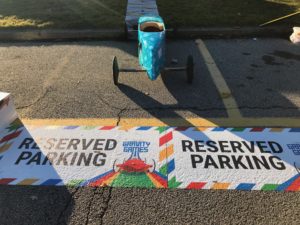
This past weekend we went down to Georgia to film the Google Gravity Games!

These Georgia Gravity Games took place in Douglasville, which is a suburb of Atlanta.  There were a few streets closed down for the GGG and on the main street is where some popular movies & tv shows have been filmed.  Among those popular tv shows are Stranger Things and MacGyver.  Pretty cool to be filming around the same areas as these popular shows!

This was our first GGG in Georgia and it was great to see how GA does it!  The boxcars were awesome  and the kids did a magnificent job of building them!  This GGG also featured Science Street, a tent where kids and adults could learn about all things science.  We partner together with Locomotion out of North Carolina to film the Gravity Games and each one we do we have a blast!

Special thanks to Locomotion Media & Innovation for partnering with us on this!


CT Army National Guard

Happy Wednesday! We had the pleasure of working with the CT Army National Guard and RC Propbusters this week in teaching 6th – 7th – 8th graders all about careers in aviation!  This has been a theme for us this month.  When both Bryan & I were that age, technology was obviously not where is it today.  With the ever evolving classroom we can’t even begin to imagine the possibilities at the kids fingertips!

David from RC Propbusters demonstrated flying, and we handled the technical side like, what are drones as well as discussing the job applications.  Among those applications were 3D modeling, thermal imaging, aerial video/photo and construction progression.  Together, we had the students:

-interact with 3D models

-learn how to read a thermal scan with our Flir thermal imager

-watch videos containing aerial photo/video

-got a sneak peak of what construction progress looks like for a construction company

All in all we had a blast the past two days teaching.  A special thank you to the Army National Guard, RC Propbusters hobbyist pilot David and also to the CT Airport Authority for partnering with us.  Looking forward to seeing the youth of tomorrow in aviation careers!